Montavilla Atlas
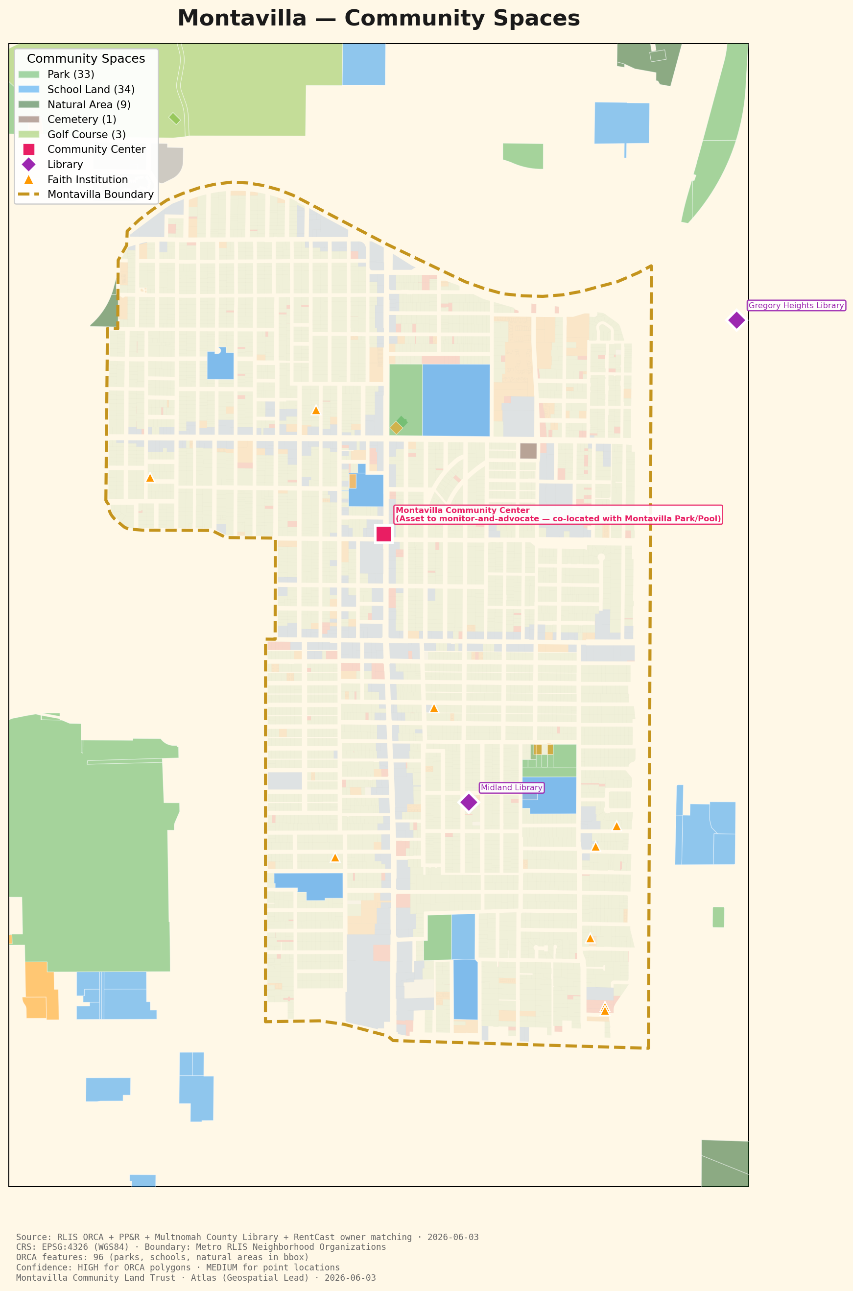
Parks, schools, natural areas, and gathering places across Montavilla, and the civic gaps between them.
← Back to the Atlas| Dataset | Source | Date | License |
|---|---|---|---|
| Community features | Metro RLIS ORCA | 2026-06-03 | Open data |
| Parks | PP&R Park Search Layer | 2026-06-03 | Open data |
| Libraries | Multnomah County Library locations | 2026-06-03 | Public info |
Counted and mapped ORCA polygon features (parks, schools, natural areas), then overlaid PP&R park boundaries and Multnomah County Library point locations.
HIGH for ORCA polygon features (an authoritative Metro dataset). MEDIUM for point locations, which are geocoded from addresses and local knowledge.