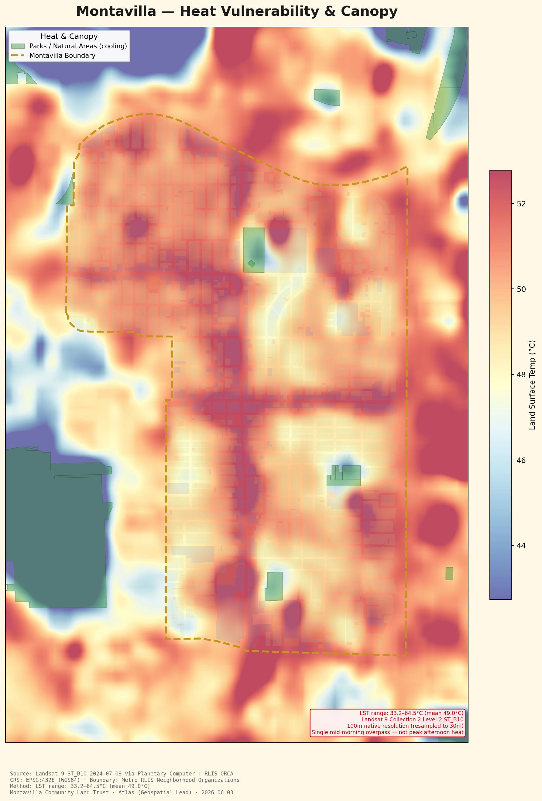
Heat Vulnerability & Canopy
Where the neighborhood runs hottest — and where tree canopy keeps it cool.
Open map →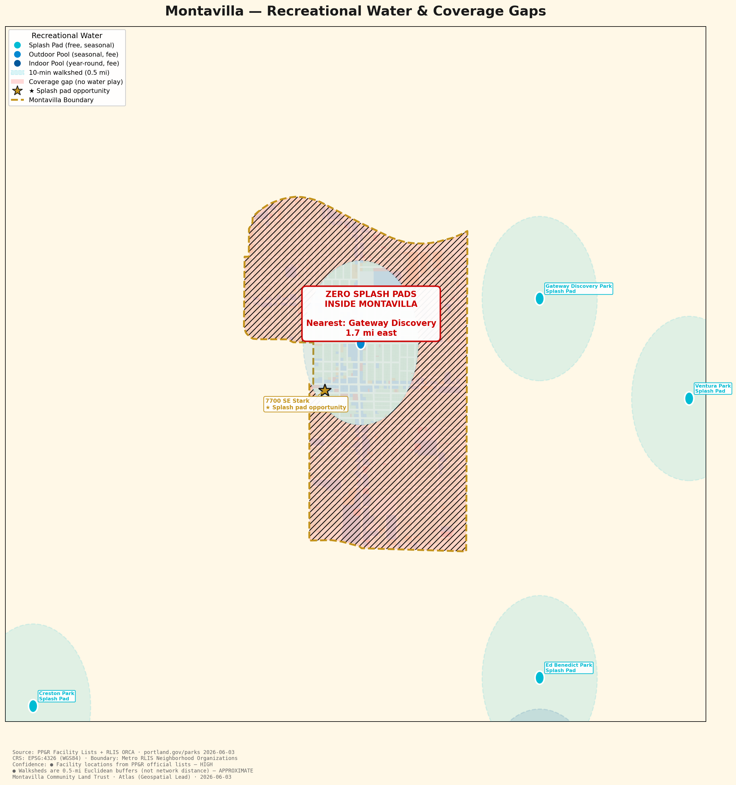
Recreational Water & Coverage Gaps
Montavilla has zero splash pads — the whole neighborhood is a water-play gap.
Open map →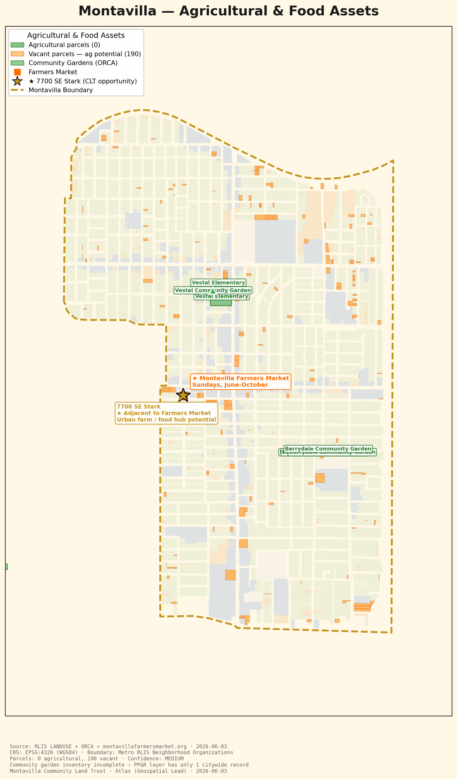
Agricultural & Food Assets
No farmland left, but 190 vacant parcels and a farmers market anchor the food story.
Open map →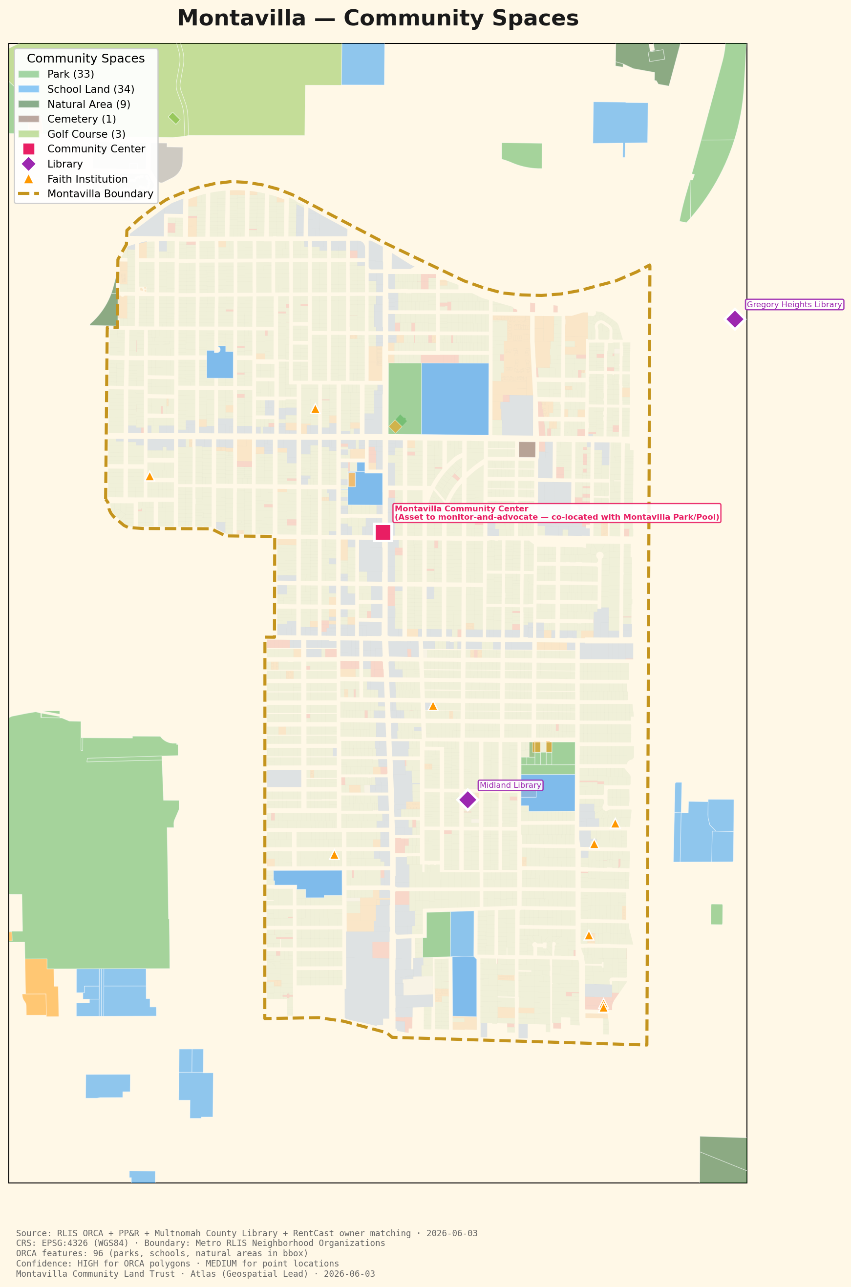
Community Spaces
Parks and schools are plentiful — but there's no public library inside the neighborhood.
Open map →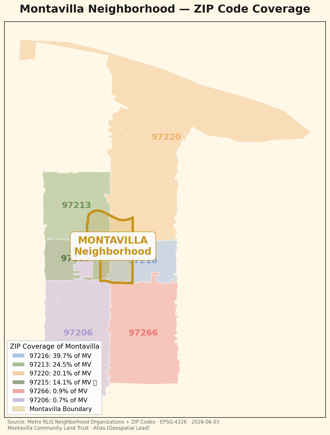
Neighborhood ZIP Coverage
Montavilla spans six ZIP codes — but four of them cover 98% of the neighborhood.
Open map →