Montavilla Atlas
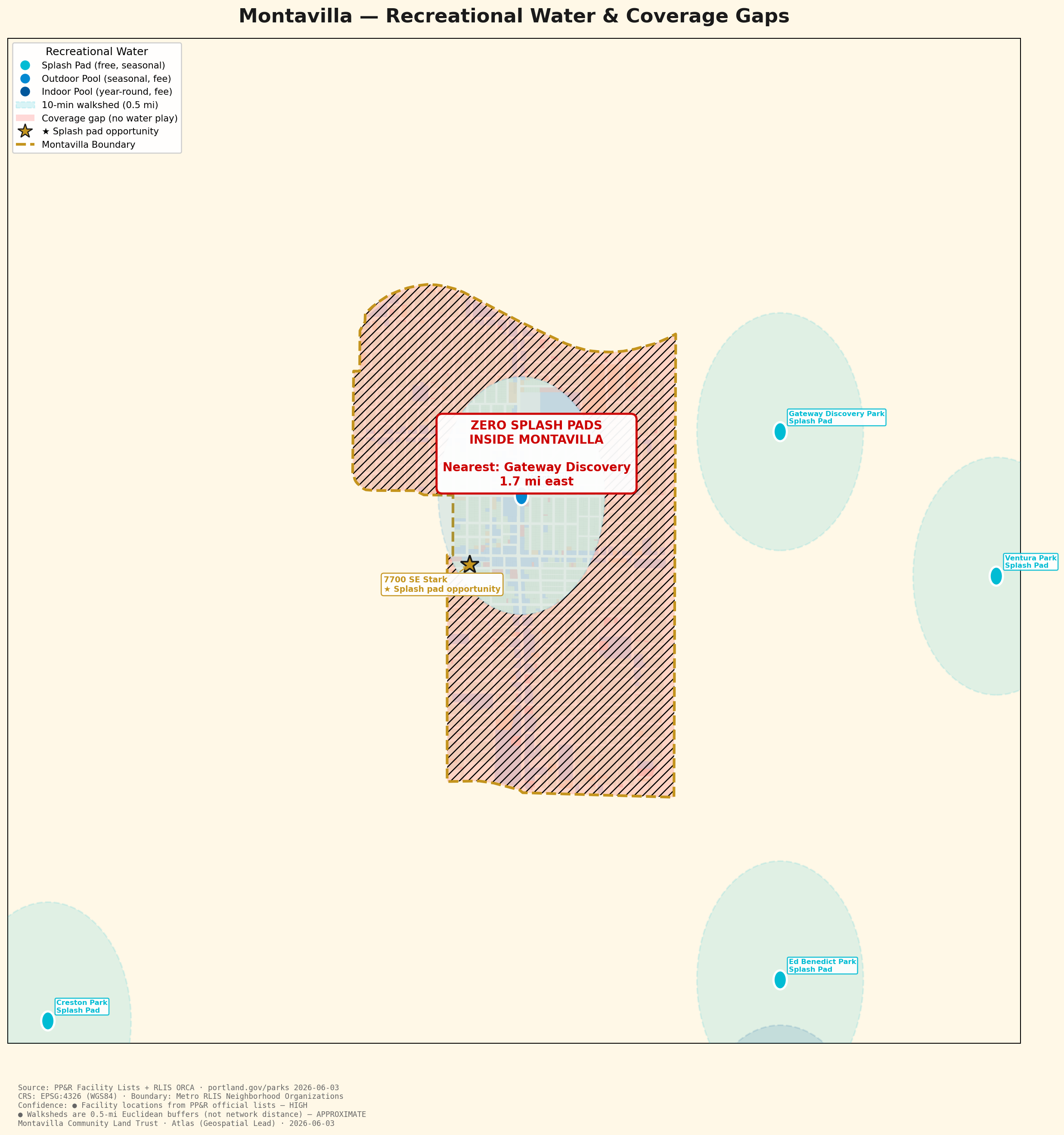
Portland Parks & Recreation water-play facilities and their walksheds, showing how far Montavilla families are from free water play on a hot day.
← Back to the Atlas| Dataset | Source | Date | License |
|---|---|---|---|
| PP&R facilities | Portland ArcGIS (Park Search, Water Features) | 2026-06-03 | Open data |
| Splash pads & pools | portland.gov/parks official lists | 2026-06-03 | Public info |
Compiled the official PP&R splash-pad and pool lists, geocoded the facilities, and mapped 0.5-mile walksheds to visualize the coverage gap over Montavilla.
HIGH for facility locations (official PP&R data). APPROXIMATE for walksheds, which use a 0.5-mile straight-line radius rather than street-network distance.