Montavilla Atlas
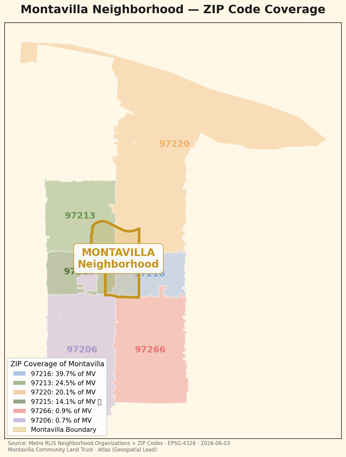
Montavilla doesn't map neatly to a single ZIP code. This shows how much of the neighborhood each ZIP actually covers.
← Back to the Atlas| Dataset | Source | Date | License |
|---|---|---|---|
| Neighborhood boundary | Metro RLIS Neighborhood Organizations | 2026-06-03 | Open data |
| ZIP polygons | Metro RLIS ZIP Codes | 2026-06-03 | Open data |
Computed the geometric intersection of the authoritative Montavilla neighborhood boundary against ZIP-code polygons in EPSG:2913 (NAD83 Oregon North) for accurate area, then expressed each ZIP's coverage as a share of total neighborhood area.
HIGH. Both inputs are authoritative Metro RLIS datasets and coverage is a direct geometric computation.